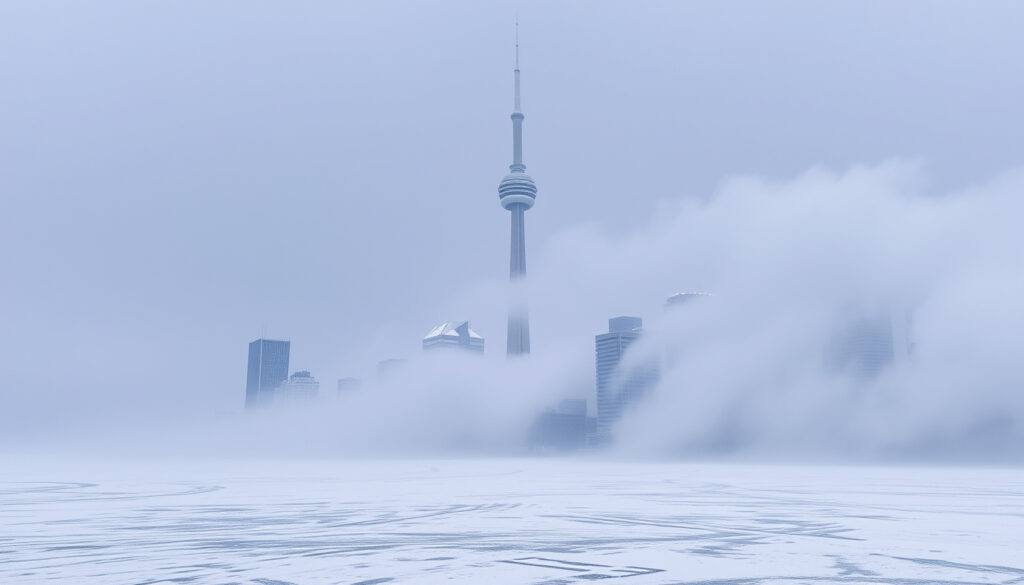
Toronto Snow Squall Warning – Current Status and Safety Guide
Toronto Snow Squall Warning: Current Status and Safety Guide
Environment Canada has not issued any active snow squall warnings for the Toronto area as of mid-April 2026. While the city currently faces a fog advisory and rainfall alert, meteorologists note that snow squalls remain a seasonal threat during the colder months when cold air sweeps across the relatively warmer Great Lakes waters.
Understanding the distinction between snow squalls and conventional winter storms is critical for residents navigating Ontario winters. These narrow but intense bands of lake-effect snow can materialize with little warning, reducing visibility to near-zero within minutes and creating hazardous driving conditions even when surrounding areas remain relatively clear. The Toronto region’s dense population and concentrated traffic patterns amplify these risks considerably.
This guide compiles the latest available information on Toronto’s current weather status, explains how snow squalls develop, outlines safety considerations, and provides context based on historical events that have affected southern Ontario communities.
What Is a Snow Squall Warning?
A snow squall warning is an official alert issued by Environment and Climate Change Canada when rapidly developing bands of heavy snow are expected to create suddenly hazardous conditions. Unlike widespread snowstorms associated with large low-pressure systems, snow squalls form when frigid arctic air masses travel across relatively warmer lake surfaces, picking up moisture that freezes into intense snowfall.
These events differ fundamentally from blizzards in several respects. Snow squalls are characteristically narrow—often just a few kilometres wide—but can produce snowfall rates exceeding five centimetres per hour. Visibility can plummet to near-zero within moments, whereas blizzards typically involve sustained heavy snow with strong winds affecting broader geographic areas over extended periods.
The mechanism behind lake-effect snow squalls makes the Great Lakes regions particularly vulnerable. When cold air moves over unfrozen lake water during late autumn and winter months, atmospheric instability generates localized bands of intense precipitation. These bands can remain nearly stationary or drift unpredictably, creating what meteorologists describe as narrow corridors of extreme winter weather.
Key Characteristics of Snow Squalls
- Sudden onset with minimal advance warning compared to traditional storm systems
- Narrow bands of heavy snow, typically 5-20 kilometres wide
- Visibility reductions to near-zero possible within minutes of passage
- Localized impact—areas just kilometres away may remain unaffected
- Higher snowfall rates than conventional snowstorms
- Formation dependent on temperature differential between air and lake water
- Greatat frequency during late autumn through early spring
Snow Squall vs. Blizzard: Understanding the Differences
Blizzards develop from large-scale atmospheric patterns and affect expansive regions with prolonged periods of sustained winds exceeding 40 kilometres per hour and significant snow accumulation. Their impacts extend across provincial or regional scales, allowing for extended lead time in forecasts and warnings.
Snow squalls, by contrast, operate on a much smaller spatial scale and develop through fundamentally different processes. They form specifically where cold air traverses open water, creating concentrated bands where moisture uptake and freezing occur rapidly. This localized formation makes prediction more challenging and explains why conditions can change dramatically within very short distances.
The practical implications for Toronto residents are considerable. A commute that begins under clear skies can quickly become treacherous if a snow squall band drifts across major transportation corridors. This unpredictability distinguishes snow squalls as particularly dangerous despite their limited geographic scope.
Current Toronto Snow Squall Warning Status
As of April 15, 2026, there is no active snow squall warning in effect for Toronto. Environment Canada’s official warnings page confirms that no snow squall alerts have been issued for the area.
Instead, the current weather pattern for Toronto includes a Yellow Advisory for fog, with Environment Canada noting near-zero visibility in some areas, particularly along the Lake Ontario shoreline. This fog advisory is expected to dissipate during the afternoon hours as temperatures rise and atmospheric conditions stabilize.
Additionally, a rainfall advisory remains in effect through Thursday, with approximately 20 millimetres of precipitation expected and locally higher amounts possible in some areas. This system represents a more typical late-spring weather pattern rather than the winter conditions required for lake-effect snow squall development.
For residents seeking to verify current conditions, Environment Canada maintains an interactive weather warnings portal where Toronto-specific alerts are published in real-time. The Weather Network also provides regional warning coverage with visual radar imagery.
Current Weather Snapshot
Environment Canada has issued a Yellow Advisory for fog affecting the Toronto area, with visibility near zero near the Lake Ontario shore. The advisory applies through this afternoon. A separate rainfall advisory is in effect through Thursday, with approximately 20 mm of additional precipitation expected.
| Alert Type | Status | Affective Areas | Expected Duration |
|---|---|---|---|
| Snow Squall Warning | None active | N/A | N/A |
| Fog Advisory | Yellow Advisory in effect | Lake Ontario shoreline areas | Through this afternoon |
| Rainfall Advisory | In effect | Greater Toronto Area | Through Thursday |
| Expected Rainfall | 20 mm baseline | Region-wide | Through Thursday |
| Local Higher Amounts | Possible | Variable | Localized |
How to Monitor Weather Updates
Staying informed during potential severe weather events requires access to reliable, official sources. Environment Canada recommends monitoring their Toronto-specific weather page for the most current watches, warnings, and advisories.
The provincial 511 Ontario traffic monitoring system provides real-time updates on road conditions, closures, and travel advisories that become particularly valuable during winter weather events when visibility and road surface conditions deteriorate rapidly.
The City of Toronto’s emergency management and weather events portal offers additional resources including snow removal schedules, emergency contact information, and community-specific guidance for winter storm preparedness.
When and Where Will the Snow Squall Hit Toronto?
Predicting the precise timing and location of snow squall events in the Toronto area presents inherent challenges for meteorologists. These localized weather phenomena develop rapidly when specific atmospheric conditions align, and their narrow bands can shift unpredictably over short time periods.
The most recent documented snow squall event affecting southern Ontario occurred November 27-30, 2025, when Environment Canada issued widespread warnings and watches across the region. Forecasts indicated potential accumulation of 30 to 50 centimetres or more in the hardest-hit areas, primarily along the Georgian Bay and Lake Huron snow belts.
Toronto’s position relative to the traditional snow squall formation zones means the city typically experiences lighter accumulation than communities directly exposed to the open lake fetch. However, this does not preclude the GTA from receiving intense, localized snow bands when conditions align favourably.
Why Toronto Is Vulnerable to Lake-Effect Snow
Toronto’s location along the northwestern shore of Lake Ontario places it in a zone where lake-effect precipitation can develop during the appropriate season. When cold arctic air masses descend across the region, the relatively warmer lake surface beneath can trigger rapid moisture transfer and intense snowfall in narrow bands.
The GTA’s high population density and extensive road network amplify the impact of even minor snow squall events. Major highways such as the 401, 400, and the Don Valley Parkway can experience sudden visibility drops that create chain-reaction collisions given the volume of daily commuter traffic.
During the November 2025 event, Toronto did not deploy snow plows as accumulation remained minimal. Despite this, the city’s emergency management teams remained on standby given the potential for traffic disruptions stemming from the concentration of vehicles in the region.
Factors That Influence Snow Squall Formation
- Temperature differential between lake water and overlying air mass
- Wind direction and speed across the lake fetch
- Atmospheric instability and moisture availability
- Presence of ice cover on lake surfaces
- Duration of cold air exposure over open water
- Geographic position relative to predominant wind direction
Safety Tips and Dangers During a Toronto Snow Squall
Snow squalls present distinct hazards that differentiate them from typical winter driving challenges. Understanding these dangers is essential for residents who may encounter these unpredictable weather bands while commuting or travelling through the GTA.
Visibility reduction represents the most immediate threat during a snow squall. Motorists have reported conditions where snow accumulation of just three to five centimetres has drastically reduced road traction and forward visibility, transforming routine commutes into dangerous navigation exercises. This is particularly treacherous on highways where vehicles travel at higher speeds and sudden stops become hazardous.
The Toronto area’s traffic density compounds these risks significantly. The region handles millions of vehicle movements daily across its interconnected highway system, meaning that even brief visibility reductions can trigger multi-vehicle collisions affecting hundreds of commuters.
Essential Safety Guidelines
- Monitor Environment Canada radar patterns to track approaching snow bands before commencing travel
- Delay non-essential trips when snow squall warnings are active
- Maintain a full tank of fuel and carry emergency supplies including blankets, water, and a charged phone
- Reduce speed significantly when visibility decreases; do not rely on adaptive cruise control in these conditions
- Use low-beam headlights to improve visibility and make vehicles more apparent to other drivers
- If a snow squall is encountered while driving, gradually reduce speed and increase following distance
- Pull safely off the roadway if conditions become unmanageable, away from active traffic lanes
- Avoid stopping on highway shoulders where passing vehicles pose collision risks
Common Hazards to Recognize
Snow squalls create conditions that differ markedly from conventional snowfall. Motorists should be aware that pavement temperatures may remain above freezing even during intense precipitation, leading to rapid snowmelt followed by flash freezing as temperatures drop. This can produce black ice conditions that are particularly difficult to detect visually.
Snow squalls can reduce visibility to near-zero within minutes of onset. During the November 2025 event, meteorologists recorded visibility drops that persisted for 15-20 minutes in affected corridors before conditions improved. Plan accordingly by checking weather radar before any highway travel during winter months.
The rapid onset characteristic of snow squalls means that conditions can deteriorate faster than drivers can react. This underscores the importance of proactive monitoring and, when possible, adjusting travel plans to avoid periods when squall activity is most likely.
Emergency Preparedness for Winter Travel
Residents who must travel during the winter months should maintain basic emergency supplies in their vehicles. This includes items that could prove essential if unexpected delays occur due to weather-related incidents.
A well-maintained vehicle emergency kit should contain a windshield scraper and brush, jumper cables, a flashlight with spare batteries, non-perishable food items, drinking water in sealed containers, a first-aid kit, and a fully charged portable phone power bank. Additional items such as sand or kitty litter for tire traction, a folding shovel, and warm clothing can prove invaluable during extended delays.
Has Toronto Experienced Snow Squalls Before?
Historical records confirm that the Toronto metropolitan area has experienced multiple significant snow squall events over the years, with the November 2025 event representing the most thoroughly documented occurrence in recent memory.
The November 27-30, 2025 event brought widespread snow squall warnings and watches across southern Ontario, with Environment Canada forecasting accumulation of 30 to 50 centimetres or more in the hardest-hit snow belt regions near Georgian Bay and Lake Huron. The event featured rapidly oscillating snow bands that shifted between northern and southern positions throughout the period.
During this event, the Toronto area received considerably lighter accumulation compared to communities in the traditional snow belt zones. The city did not activate its full snow removal apparatus given the minimal expected accumulation, though municipal emergency management teams remained prepared for potential traffic disruptions given the GTA’s concentrated population.
November 2025 Event Timeline
- November 27: Environment Canada issues initial snow squall warnings for southern Ontario regions near Georgian Bay and Lake Huron
- November 28: Snow bands begin oscillating, affecting multiple communities in alternating patterns
- November 29: Peak activity period, with some areas receiving significant accumulation while others remain relatively unaffected
- November 30: Warnings begin lifting as atmospheric pattern shifts and temperature differentials decrease
Regional Impact Patterns
The GTA’s relationship to lake-effect snow patterns means that while Toronto proper may receive comparatively modest accumulation, the surrounding municipalities and communities positioned in the traditional snow belt zones can experience dramatically different conditions during the same weather events.
This disparity creates challenges for emergency management planning, as resources must be prepared for potential escalation even when initial forecasts suggest limited impact for the core city area. The concentration of critical infrastructure—including major hospitals, airport facilities, and transportation hubs—within Toronto proper demands heightened readiness regardless of predicted local accumulation.
Current Forecast Confidence and Uncertainty
Weather forecasting for localized events such as snow squalls inherently carries different uncertainty profiles compared to large-scale storm predictions. Understanding these limitations helps residents interpret official forecasts and warnings appropriately.
Environment Canada’s official position remains that no snow squall warnings are currently active for the Toronto region. The existing fog advisory and rainfall alert represent the extent of official weather warnings as of mid-April 2026.
Established Information
| Parameter | Current Status | Confidence Level |
|---|---|---|
| Snow Squall Warning Status | None active | Confirmed via official sources |
| Fog Advisory | Yellow Advisory in effect | Confirmed |
| Rainfall Advisory | Through Thursday | Confirmed |
| November 2025 Event Occurrence | Documented | Historical record |
| Lake-Effect Mechanism | Scientifically established | High scientific confidence |
Remaining Uncertainties
| Parameter | Current Understanding | Confidence Level |
|---|---|---|
| Future snow squall timing | No prediction available | Cannot be forecast |
| Precise band trajectories | Cannot be predicted more than hours in advance | Low to moderate |
| Accumulation estimates | Vary by location and conditions | High uncertainty |
| Duration of individual bands | Typically 15-30 minutes per band | Moderate historical pattern |
| Next significant event | Unknown; dependent on future atmospheric patterns | Cannot be forecast |
Snow squall forecasting differs fundamentally from conventional winter storm prediction. The localized nature of these events means that even hour-by-hour forecasts carry inherent uncertainty, as individual snow bands can form, intensify, and dissipate rapidly based on micro-scale atmospheric conditions that current models cannot fully resolve.
Why Snow Squalls Develop and Toronto’s Exposure
Lake-effect snow represents a distinctive meteorological phenomenon that occurs when large bodies of water retain heat accumulated during summer months, releasing it slowly during autumn and early winter. This temperature differential creates atmospheric instability when frigid arctic air masses traverse the relatively warmer lake surfaces.
The Great Lakes system makes southern Ontario particularly susceptible to these conditions. Lake Ontario, with its significant thermal mass, can generate lake-effect precipitation well into December and even January if ice coverage remains incomplete. The fetch length—how far air travels across open water before reaching land—determines the intensity and duration of resulting snow bands.
Toronto’s metropolitan structure amplifies vulnerability to these events in ways that rural communities do not experience. The sheer density of residential and commercial development, combined with extensive road and highway networks, means that snow squall impacts can extend far beyond their meteorological significance.
The regional economy depends heavily on the free flow of traffic through these corridors. Any degradation of road conditions—whether through reduced visibility, accumulation-related traction loss, or accident-related closures—generates economic costs that multiply rapidly through delayed shipments, missed appointments, and reduced worker productivity.
Community Resilience Considerations
Municipal emergency management for snow squalls requires balancing resource allocation against potential impact scenarios. Given that Toronto often receives lesser accumulation than traditional snow belt communities, deploying full winter maintenance resources preemptively may prove economically inefficient.
However, this approach carries risk. The November 2025 event demonstrated that even modest snow squall activity in the GTA can create conditions disproportionately severe relative to actual accumulation totals. Traffic modelling from that event suggested that visibility reductions of even a few minutes duration could create multi-hour delays given the region’s vehicle density.
Official Sources and Expert Guidance
Environment Canada remains the authoritative source for weather warnings affecting Toronto and the surrounding region. Their meteorologists continuously monitor atmospheric conditions and issue alerts when criteria for watches and warnings are satisfied.
The agency’s official position provides the most reliable baseline for understanding current weather threats. Their warning criteria for snow squalls include specific thresholds for visibility reduction, snowfall intensity, and expected duration of hazardous conditions.
Environment Canada advises that snow squalls can develop with minimal advance notice and urges residents to monitor official forecasts and radar imagery regularly during the winter season.
— Environment and Climate Change Canada, Public Weather Messaging
Meteorological analysis from regional forecast centres indicates that the conditions required for lake-effect snow squall development—open water, sufficient temperature differential, and appropriate wind trajectories—occur most frequently during November through February for the Lake Ontario corridor.
Snow squalls represent some of the most challenging weather events to forecast and communicate due to their small spatial scale and rapid development. Communities should maintain vigilance during the traditional lake-effect season regardless of current warning status.
— Regional Meteorological Analysis, Southern Ontario Climate Centre
Summary and Recommendations
As of mid-April 2026, no active snow squall warnings affect the Toronto region. Current weather advisories focus on fog conditions along the Lake Ontario shoreline, expected to dissipate this afternoon, and a rainfall advisory in effect through Thursday.
The most recent significant snow squall activity in southern Ontario occurred during late November 2025, when Environment Canada issued widespread warnings for the traditional snow belt regions. Toronto experienced relatively light impact during that event, though traffic disruptions remained a concern given the city’s population density.
Residents preparing for future snow squall potential should establish reliable methods for receiving official weather notifications, maintain emergency supplies in their vehicles during winter months, and develop habits of checking conditions before commencing highway travel. Those seeking information on winter driving conditions in surrounding areas may find resources at Drive Test Near Me Ontario helpful for understanding regional driving requirements.
For current information on active weather warnings, residents should consult Environment Canada directly through their official warnings portal or monitor local media outlets that relay official forecast and warning information.
Frequently Asked Questions
How is a snow squall warning different from a winter storm warning?
Snow squall warnings focus on narrow bands of intense, localized snowfall with sudden visibility reductions, while winter storm warnings address larger-scale systems with prolonged precipitation and sustained winds affecting broader geographic areas.
What should I do if I encounter a snow squall while driving on the highway?
Reduce speed gradually, increase following distance, use low-beam headlights, and avoid stopping on shoulders. If conditions become unmanageable, pull completely off the roadway away from active lanes and wait for conditions to improve.
Does Toronto typically experience heavy snow from lake-effect squalls?
Toronto often receives less accumulation than communities in the traditional snow belt zones near Georgian Bay and Lake Huron. However, localized bands can still create hazardous driving conditions with minimal accumulation.
Where can I find real-time weather warnings for Toronto?
Environment Canada’s official warnings portal at weather.gc.ca provides current watches, warnings, and advisories for Toronto and surrounding areas. The site is updated continuously as conditions change.
What supplies should I keep in my car during winter months?
Emergency vehicle supplies should include a windshield scraper and brush, jumper cables, flashlight with batteries, non-perishable food, sealed drinking water, first-aid kit, and a fully charged portable phone battery bank.
Can snow squalls be accurately predicted days in advance?
Due to their small spatial scale and rapid development, snow squalls are difficult to forecast with precision more than several hours ahead. Forecast confidence increases as events approach.
When is Toronto most at risk for snow squalls?
The traditional lake-effect snow season for the Lake Ontario corridor extends from November through February, when cold air masses can develop the temperature differential with lake water necessary for snow squall formation.
More related posts
 1 Bitcoin to USD: Live Price at $78,464 & Converter
 Complete List of Christopher Briney Movies and TV Shows
 Bureau en Gros Place Versailles: Hours, Services & Contact
 Bill Gates: Biography, Net Worth, Philanthropy, and Current Activities
 Jane App Sign In Guide: Staff, Admin, Practitioner, Patient
 Hayden Panettiere: Daughter, Custody, and Why She Left Acting
 Toronto to Thunder Bay Flights: Cheap Deals from $61
 Electronics Store Near Me: Currys, Harvey Norman in Ireland
